

Poplar Bluff
Historical promotional booklet issued under the auspices of the Poplar Bluff Chamber of Commerce and Kiwanis Club
Original preserved by Original physical booklet not held by Historic Poplar Bluff · Digitized by Historic Poplar Bluff (edition assembled from contributor-provided scans courtesy of Bill Clanahan)
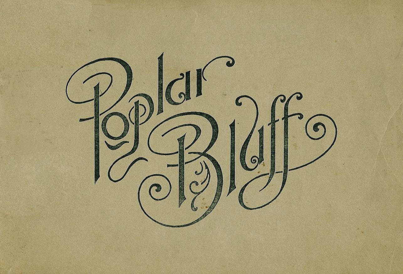
Cover of the Poplar Bluff promotional booklet, issued under the auspices of the Poplar Bluff Chamber of Commerce and Kiwanis Club.
Read the Booklet
Digital edition shown for on-site reading. No download or redistribution.
Each page is shown to fit the reader. Use the arrows to turn the pages, or read the transcription below. Full-size scans can take a few moments to open the first time.
About This Document
A promotional booklet encouraging home seekers, investors and manufacturers to settle in Poplar Bluff and Butler County. It combines civic description, population statistics from 1850 to 1926, lists of industries and institutions, essays by local and visiting writers, an agricultural section, about 60 captioned halftone photographs, a Butler County highway map, a street map of Poplar Bluff by Victor H. Van Sant, and a regional distance map. This digital edition was assembled by Historic Poplar Bluff from contributor-provided scans (31 pages plus cover notes).
Speaker / Author
Poplar Bluff Chamber of Commerce and Kiwanis Club
Date
Undetermined (after 1925-26; population table ends at 1926)
Location
Poplar Bluff, Butler County, Southeast Missouri
Details
- Date:
- Undetermined (after 1925-26; population table ends at 1926)
- Creator:
- Poplar Bluff Chamber of Commerce and Kiwanis Club
- Place created:
- Poplar Bluff, Missouri
- Format:
- Printed promotional booklet, landscape format, with halftone photographs, maps and illustrations
- Document type:
- Book / Booklet
- Language:
- English
- Pages:
- 31
- Era:
- 1920s
- Condition:
- Scans show toning, foxing and edge wear typical of a 1920s paper booklet; pages are legible. Completeness of the original has not been verified.
The booklet states it was published under the auspices of the Poplar Bluff Chamber of Commerce and Kiwanis Club, underwritten by local business interests. Individual articles are credited to Captain Roy Godsey, M. C. Horton and F. H. Darnall, and the foreword is signed by W. H. Meredith, president of the Chamber of Commerce. A definitive publisher and publication date have not been established.
The booklet dates from the mid-1920s: it cites The Missouri Manual of 1925-6 and ends its population table at 1926 (12,000). It records the new state highway system (Routes 16, 23, 53, later Federal Highways 62 and 67), the three railroad terminals (Missouri Pacific, Frisco and Butler County), the 1873 arrival of the St. Louis, Iron Mountain & Southern, and the proposed Black River hydro-electric project (Lake Meredith). It is a promotional source and its claims, such as "best paved streets in Missouri," reflect civic boosterism and should be corroborated.
"Poplar Bluff was selected as the seat of justice in Butler county in 1850."
"If there is any one fact in the history of Poplar Bluff standing out more definitely than any other it is the fact that the city has never had a boom."
"Like Rome of old, all the state roads in the district lead to Poplar Bluff, and it has better railroad facilities than any other city of its size in the United States."
"The stability of the city is found in the fact that it is not a one-industry town."
"It is likely the Osages, Shawnees and the Delawares and other Indian tribes first traversed this trail around which a town built when Poplar Bluff became a trading post."
Cover and Front Matter
Cover (p. 3): "Poplar Bluff" in ornate hand-lettered script on a tan paper cover.
Digital edition notes (pp. 1-2): Assembled by Historic Poplar Bluff from contributor-provided images courtesy of Bill Clanahan. The original physical booklet has not been examined or digitized by Historic Poplar Bluff.
Poplar Bluff (pp. 4-5)
Illustration: Missouri Pacific Station.
Poplar Bluff is described as the point where east, west, north and south meet. Butler County, at the center of which the city is located, is "a cross section of America so to speak." The booklet calls it the largest city in the Mississippi valley for the stage of development of the territory tributary.
Historical Background
Poplar Bluff was selected as the seat of justice in Butler County in 1850. The site was purchased with funds solicited from pioneers who the year before had succeeded in getting Butler County created by act of the legislature. The land was sold at auction and the funds were used to build county buildings. The city nestles on the bluffs skirting the west bank of Black river where the southeastern Missouri Ozarks dip down into the delta region. Upon the bluffs once grew a giant forest of poplars, and the designation "Poplar Bluff" in the forests became the name of the city. The county was named for Benjamin F. Butler, Attorney General under President Andrew Jackson during his second term, 1833-37.
Poplar Bluff was a straggling village of a few householders during the Civil war and never registered growth until the building of the St. Louis Iron Mountain & Southern in 1873. In the 80's the real growth started and has continued without booms.
Poplar Bluff, "Little Pittsburgh"
Dean Walter Williams of the University of Missouri School of Journalism, some years ago, dubbed Poplar Bluff "Little Pittsburgh" because of the stacks of the industrial district.
Calls to Empire Builders
Poplar Bluff is described as an imposing town of 12,000 population and Butler county 30,000.
Where Is Poplar Bluff?
Principal city of lower Southeast Missouri. Distances: St. Louis 169 miles north; Cape Girardeau 65 miles northeast; Cairo, Illinois 75 miles east; Memphis 160 miles southeast; Little Rock 180 miles south; Springfield 235 miles west. The city occupies about four square miles, estimated wealth ten million dollars, and is the county seat of Butler county.
Churches and Schools
Nineteen churches, a large high school, seven modern grade schools and an eighth under construction at a cost of $75,000, one large parochial school, one business college, one school of music, four hospitals and a public library. Fifteen hotels, fair grounds and race track, four theaters, a bathing beach on Black river, playground and a baseball park.
Municipal Improvements
Ten miles of paving and concrete sidewalks; municipal water and light plant valued at $500,000; modern sewer system; $85,000 post office building; municipal building; Missouri Pacific railway station and offices; Frisco and Butler County railway depots. Streets described as the best paved and best lighted in Missouri; business section paved with brick to the specifications of New York City. Motorized fire department and police department.
Building Activities
Population increased twenty-five per cent in the past five years. A garage planned to occupy an entire block on Second street facing the courthouse; a three story fireproof building projected in the business district; a mercantile building under construction on Main street; a large factory building planned; three brick bungalows in one block.
Civic Organizations
Two daily and two weekly newspapers, Chamber of Commerce, Y. M. C. A., Masonic, Knights of Pythias, Elks Clubs, Odd Fellows and Knights of Columbus. Kiwanis Club, Woman's Community Club, Farm Bureau. Schools approved by the Central Association. A Ministerial Alliance of pastors.
Photo captions (p. 5): "Main street looking south from Poplar, Bank of Poplar Bluff in left foreground and Dalton store in right foreground." "The bluff overlooking Black river. It was once covered with a growth of poplar trees."
Population Table and District Organizations (p. 6)
Poplar Bluff population: 1850 survey of townsite on U.S. Land Grant, first lots sold May 17; 1860 15 houses; 1880 791; 1890 2,187; 1900 4,321; 1910 6,916; 1920 8,043; 1926 12,000.
Captions: "Ferguson Building." "Frisco Station, Poplar Bluff."
District Organizations
The Chamber of Commerce is a member of the Missouri Ozarks Chamber of Commerce (Ellington, Missouri), promoting "The Big Springs Country"; Butler is one of fourteen counties in the campaign. It is also a member of the Missouri Association, the state chamber (Jefferson City), and of the Southeast Missouri Agricultural Bureau, one of eight delta or lowland counties (Dexter, Missouri), covering 3,000,000 acres of lowland.
Financial Institutions and Railroad Center (pp. 7-8)
Photos: State Bank of Poplar Bluff; Begley Block.
Four banks with total footings of approximately $3,229,623.04 and five other banks in Butler county, a building and loan association with a capital of $2,000,000 and a Federal Farm loan Association.
Poplar Bluff Railroad Center
On Black river, navigation extending to this point. Headquarters of the Missouri Division of the Missouri Pacific; terminus of the Cairo-Poplar Bluff line; freight division on Frisco (Cape Girardeau-Hoxie line), with connection between the St. Louis-Memphis line at Cape Girardeau and Kansas City-Memphis line at Hoxie and the Springfield line at Mingo. Headquarters, terminal and shop of the Butler County railway, an interstate carrier connecting with the St. Louis Southwestern (Cotton Belt Route) at Piggott, Arkansas. Thirty daily passenger trains; direct lines to Mississippi river barge service at St. Louis, Cape Girardeau, Cairo, Memphis and Helena.
Hub of Highway System
- Route 16 connects the city with Cairo, Illinois; 18-foot concrete pavement, sixteen miles east of Poplar Bluff; passes across the delta region where $40,000,000 has been expended for drainage. Route 16 northwest to Van Buren and across the state through Springfield and Joplin.
- Route 53 southeast to Route 25 in Dunklin county, direct highway to Memphis.
- Route 23 south to the Arkansas state line at Moark connecting with Arkansas State Highway 1A to Little Rock; north to St. Louis through the Eastern Ozarks.
- Route 43 intersects No. 23, 14 miles southwest, to Doniphan and West Plains.
- State Highway 16 (Cairo through Poplar Bluff) designated Federal Highway No. 62; State Highway 23 (St. Louis through Poplar Bluff to Little Rock) designated No. 67.
Water Power Permit
A federal power permit issued for a hydro-electric plant on Black river north of the city. The Black river project would create Lake Meredith, fifteen miles in length; six hydro-electric power dams promoted in the Poplar Bluff district.
Captions (p. 8): "Municipal light and waterworks building." "Interior of Municipal light and water plant."
Industry and Commerce (p. 9)
Poplar Bluff Industrial Town
Thirty-two mills and factories. Iron and clay deposits being developed. Seven manufacturers of lumber for the wholesale market. The Hamilton-Brown Shoe Company has a large plant; the Brooklyn Cooperage Company was declared the largest cooperage works in the world; the Bimel-Ashcroft Manufacturing Company makes spokes for motor and vehicular traffic; the Poplar Bluff Ice and Fuel Company has one of the largest ice and cold storage plants in the state. Products range "from candy suckers for the kiddies to the coffins and monuments for the departed."
Mercantile Center
Four wholesale houses; five brokers; eight department stores; thirty grocery establishments; seventeen dry goods stores; ten furniture and hardware stores; five markets; ten automobile dealers.
Poplar Bluff Produces
Bakery products, breakfast food, butter, corn meal, candy, cannery products, flour, ice, ice cream, packing products, soda water, cigars, box shooks, barrels, cabinet work, cedar chests, car material, doors, coffins, furniture, heading, hoops, handles, oil well sucker rods, shingles, spokes, veneer, wagons, window sash, casting iron, car wheels, harness, sheet metal work, shoes, marble sculpture and greenhouse products.
Manufacturing Future Promising
Two large power plants, one city-owned and the other the Missouri Utilities Company, which serves Poplar Bluff, rural communities and towns throughout Southeast Missouri.
Captions: "Broadway looking south from Vine. The Postoffice in the left foreground, with Gibbons Hotel next. The Fraternal building in the foreground on the right with Bacon block next." "Bank of Poplar Bluff Building."
Poplar Bluff and Butler County Through the Eyes of a Non-Resident (pp. 10-11)
By Captain Roy Godsey, Jefferson City (engaged in writing a history of Missouri).
Quoted voices: John H. Patterson, Lieutenant Governor of the Mo-Kan-Ark district of Kiwanis International ("Poplar Bluff has never been looked upon as a boom town"); Earl Doane, consulting engineer (iron and ceramic clay resources); Frank Case, secretary of the Poplar Bluff Chamber of Commerce (labor survey); F. H. Darnall, County Farm Agent ("Forty per cent of Butler county is upland and sixty per cent lowland"); Ernest Bacon, owner of one of the finest stock farms in the lowlands, pioneer herd of Black Aberdeen-Angus cattle; Henry McWilliams of the Butler County Auto Company, Ford dealer; John Sparkman, farm in the northwest part of the county where the county seat was first located; Charles Reign Scoville, D. D., evangelist who owns Butler County land.
Only twenty per cent of the county's 467,000 acres is developed. Butler County farms increased 100 per cent from 1910 to 1920. About 17 1/2 miles of hard surfaced road to be completed; the Memphis road is the one unfinished state highway in the county. High school is a member of the North Central Association; its Glee Club is the largest in the state in proportion to population.
Captions: "Dalton Store." "Criterion Theater Building." "Poplar Bluff Loan & Building Association."
Poplar Bluff, Its Past, Present and Future (pp. 12-13)
By M. C. Horton. The writer located in Poplar Bluff forty years ago, a town of about 1000 people. The St. Louis, Iron Mountain and Southern Railroad was about the only means of ingress and egress. There were only three brick structures. Main Street was built along the cow path following the ridge to the North and Northwest. The only industry was the saw mill and a partial division point of the one railroad.
The railroad asked citizens to establish a Y. M. C. A., and money was raised by public subscription. The old frame depot burned; citizens subscribed $50,000 in bonds so the Missouri Pacific would build a $50,000 modern depot. The Frisco Railroad's right of way was purchased by public-spirited citizens, and the Butler County Railroad Company entrance was likewise secured by citizen contributions. The Dalton Adding Machine Company was compelled to remove from Poplar Bluff leaving a large industrial building unoccupied; citizens subscribed $50,000 to secure the Hamilton-Brown Shoe Company to use the old Dalton factory building. A half million dollar bond issue for state highways carried by a large majority; five state highways radiate from Poplar Bluff.
Captions: "Hotel Ducker." "Bluff City Business College and Barnett School of Music." "Lucy Lee Hospital." "Poplar Bluff High School." Small photos, left to right: "Butler County Court House; Main Street south from Oak St.; Qulin School in Butler Co., and Williamson-Kennedy School."
Churches, Residences and Civic Pride (pp. 14-17)
Captions (p. 14): "First Christian Church." "The Elks Home" (marked "Copyrighted by Kennedy"). Left to right: "Second Baptist Church; residence of Joseph Ashcroft; residence of M. C. Horton, and Sacred Heart Catholic Church."
Horton continues: the transition from timber to agriculture; bottom lands under drainage; Southeast Missouri was the only portion of the state to show an increase in rural population between the 1910 and 1920 census.
p. 15: "If there is any one fact in the history of Poplar Bluff standing out more definitely than any other it is the fact that the city has never had a boom." Primary trade territory of approximately 150,000 population per the Chamber of Commerce; no town of more than 500 population within its trade zone. "The stability of the city is found in the fact that it is not a one-industry town." Captions: "First Baptist Church." Residences of E. W. Graves; L. T. Metz; T. F. Ray; J. S. Gray, and C. A. Gierth.
p. 16: The City of Poplar Bluff owns utilities worth $400,000. Captions: "Poplar Bluff Postoffice" (upper right); "Interior of power plant of Missouri Utilities Co" (lower left); "Exterior of Missouri Utilities Co." (lower right).
Missourian's Estimate of Missouri (pp. 17-18)
Remarks of Roy B. Weisenburger, vice-president of the National Bank of Commerce, St. Louis, a supporter of the Missouri Association for a Greater Missouri, the Missouri Ozarks Chamber of Commerce and the Southeast Missouri Agricultural Bureau, on Missouri as the "Show Me" state, the Ozark strawberry, and loyalty to Missouri.
Captions: "Proposed Methodist Church." Residences of Hubert Roland, W. H. Kennedy, Sam M. Phillips, H. Y. Mengel and John C. Corrigan. "Ruth Flats." "Three houses under construction in one block."
"The Big Springs Country" of the Missouri Ozarks (pp. 18-22)
Poplar Bluff is the gateway to "The Big Springs Country." Rivers named include the Current River, the Eleven Points, the Black River, Mineral Fork, the Jacks Fork, the Big River, the North Fork, the Big and Little Piney, the Gasconade and the Meramec. Of eight State Parks, five are in this section. The booklet quotes The Missouri Manual of 1925-6, an official state publication: Big Springs, five miles south of Van Buren, Missouri, is "conceded to be one of the largest springs in the world"; the state acquired over 20,000 acres of wild timbered land and paid out $174,000.00 for these springs and park land.
Start a New Day in Southeast Missouri
Roger Babson and Arthur Brisbane are cited as saying the next forward movement of people will be to the Ozark region.
Captions: "Poplar Bluff plant of the Bimel-Ashcroft Manufacturing Company." Left to right: "Hanna & Young Handle Co.; Brooklyn Cooperage Co., and Poplar Bluff Handle Works." "Hamilton-Brown Shoe Company." Left to right: "Large baking plant; interior of Woodburn Creamery Co., and Candy factory building." "Poplar Bluff Ice & Fuel Company. At the left of the picture is the Butler County Milling Company." "Summer on Black River" (swimmers). "Outing in the Missouri Ozarks" and duck hunting. "A scene along the Missouri Pacific north of Poplar Bluff" (p. 23, illustration signed J. LeBrun Jenkins).
Maps and Emblems (p. 24)
Map of Butler County showing state highways 16, 23, 42 and 53 radiating from Poplar Bluff; St. Francis River on the east. Text: "At no spot in the state except in the larger centers will so many roads be found leading into one center as in the case of Poplar Bluff... Butler county voted $500,000 for county roads and these highways are yet to be built." Emblems: Poplar Bluff, Mo. shield and Kiwanis Club International seal.
Butler County (pp. 25-30)
Butler County is one of the southern tier of counties, its county seat Poplar Bluff at the center, twenty miles from the Arkansas state line, 169 miles from St. Louis and seventy-five miles west of the Mississippi river. Called the "richest spot on earth." The county contains 447,360 acres; forty per cent upland and sixty per cent lowland.
- Drainage: the entire county has drainage systems.
- Live Stock: Aberdeen-Angus, white face, Jersey and Holstein herds; Japanese clover.
- Cost of Land: undeveloped upland $5 to $25 per acre, cultivated $25 to $75; lowland wild $15 to $35, cultivated $50 to $125.
- Inter-River Basin: Black river passes north and south through the center of the county; the St. Francis river is the eastern boundary. Valleys of Cane Creek, Ten Mile Creek and Little Black river.
- Butler County Has: 650 miles of public roads, 110 rural schools, 345 miles of drainage ditches; assessed valuation $15,000,000; total rail mileage 103.87 miles.
- Farm Life: a farm bureau and farm agent; vocational agriculture at Poplar Bluff High School; nine cotton gins, five flour mills, several corn mills, one rice mill; Poplar Bluff is an important raw fur market of the Missouri Ozarks.
An Acre in Butler County Has Produced
Wheat 35 bushels; Corn 80 bushels; Oats 60 bushels; Cotton 2250 pounds; Timothy 2 tons; Clover 2 1/2 tons; Rice 125 bushels; Alfalfa 4 tons.
A Message from the County Extension Agent
By F. H. Darnall, Agent. Marketing organizations named: Truck Crop Producers Association, Fruit Growers Association, Live Stock Shipping Association, Missouri Cotton Growers Association (American Cotton Growers Exchange). Earliest truck crop land in the state, potatoes ready by June 1. A strawberry campaign was just completed with peaches next. Butler can point to more farms owned by the farmers living on them than any other county in Southeast Missouri.
For More Information
The catalogue was "published under the auspices of the Chamber of Commerce and Kiwanis Club" with business interests underwriting its publication.
Captions: "Field of Cowpeas." "Butler County Beef Cattle." "Showing Height of Butler County Wheat." "Herd of Aberdeen-Angus cattle on Butler county stock farm." "Field of Tobacco." "Field of growing corn." "Field of clover."
To Home Seekers (p. 31)
Signed W. H. Meredith, President, Chamber of Commerce. Poplar Bluff is "the gate-way and hub city of Southeast Missouri and Northeast Arkansas." "Like Rome of old, all the state roads in the district lead to Poplar Bluff." Located on the last foot-hill of the Ozarks on the banks of Black River; large deposits of iron ore and clays; when Black river is harnessed it will make cheap power.
Caption: "Left to right: Residence on McCauley farm near Harviell; corn field; dairy herd; wheat field and cotton field."
Map of Poplar Bluff (p. 32)
Street plan of Poplar Bluff, Missouri, by Victor H. Van Sant, scale 360 feet = 1 inch, with street-lights marked and churches, schools (North Side, Wheatley, Benton, West End, East Side, High School), Court House, City Hall, Post Office, Opera House, Y.M.C.A. and stations located. Black River, Frisco and Iron Mountain/Southern railways shown. Note: "several additions beyond the corporate limits contain a population of almost 2,000. The reader will note that Main street winds about on the plat of the city. It is likely the Osages, Shawnees and the Delawares and other Indian tribes first traversed this trail around which a town built when Poplar Bluff became a trading post."
Back Cover Map (p. 33)
"Mo-Ark Empire" emblem with "Poplar Bluff." A circular map showing distances to St. Louis, Springfield, Cairo, Memphis and Little Rock, and "the trunk line railroads into Poplar Bluff, the Missouri Pacific and Frisco. In addition the Butler County, an inter-state carrier, connects Poplar Bluff with the St. Louis & Southwestern (Cotton Belt Route) at Piggott, Arkansas."
Useful as a snapshot of how civic leaders presented Poplar Bluff around 1926. Particularly valuable for: the population table (1850-1926); named businesses and their captioned photographs (Hotel Ducker, Dalton store, Begley Block, Ferguson Building, Criterion Theater, Lucy Lee Hospital, Elks Home, Bimel-Ashcroft, Hamilton-Brown Shoe, Brooklyn Cooperage, Poplar Bluff Ice & Fuel, Missouri Utilities); M. C. Horton's recollection of the town about forty years earlier (when Main Street followed a cow path and there were only three brick buildings); the 1920s street map; and county agricultural data.
People & Organizations Mentioned
Chamber Of Commerce Of Poplar Bluff
commercial
Poplar Bluff Kiwanis Club
commercial
Butler County Milling Co.
commercial
Hanna & Young Handle Co.
commercial
Woodburn Creamery Co.
commercial
Hamilton-Brown Shoe Co.
commercial
Poplar Bluff Ice & Fuel Co.
commercial
Missouri Utilities Co.
commercial
Bluff City Business College
commercial
Poplar Bluff Loan And Building Association
commercial
Missouri Pacific Railroad
transportation
St. Louis-San Francisco (Frisco) Railroad
transportation
Elks Club
civic
Dalton's
commercial
Dalton Adding Typewriter Company
industrial
Criterion Theatre
entertainment
State Bank
financial
Begley Building
commercial
Poplar Bluff Post Office
civic
Lucy Lee Hospital
commercial
Related Historic Sites

Bank of Poplar Bluff
200 S. Main
1910s
State Bank of Poplar Bluff
1940s
Criterion Theater
129 N. Main Street, Poplar Bluff, MO
1910s
Historic Post Office
Downtown Poplar Bluff
1910s
Elks Club
4th NW corner Poplar
1900sLucy Lee Hospital
1920s
Poplar Bluff Loan & Building Association
117A S Main
1900s
Railroad YMCA (RRYMCA)
Near Iron Mountain Train Depot
1910s
Ducker Hotel
319-321 S Main
1920s
Gibbons Hotel
328 Poplar
1920s
Frisco Railroad Depot (Railroad Museum)
303 Moran Street
1920sBrooklyn Cooperage Company Site
1900sDalton Hardware & General Store
1880s
Dalton Adding Machine Company
Poplar Bluff, Missouri (exact factory site unknown)
1900sSource & Provenance
Contribution and permission: The digital scans of this booklet were contributed to Historic Poplar Bluff by Bill Clanahan, with documented permission to archive and display the booklet here. His credit identifies the source of the scans; copyright ownership of the original booklet is not established by this permission.
Digital scans provided by Bill Clanahan, with documented permission to archive and display them on Historic Poplar Bluff. The booklet is presented here through its transcription and images; the complete digital edition is not offered for download or redistribution. Copyright status of the original booklet is undetermined, and this record conveys no right to reuse or distribute the scans.